The IMCS Network has collated a range of cost-effective resources that may be accessed and used by our community to support their work.
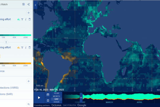
The Global Fishing Watch map was the first open-access online platform that provided visualization of fishing activity at scale. It supports dynamic filtering and different ways of interacting with the billions of data points it displays (both AIS and VMS data for specific areas). It summarizes data in dot density maps and vessel track maps. Dot density maps use shapes to show the presence of vessels and can be used to examine vessel density and movement. Vessel track maps use lines to represent the tracks of vessels and can be used to analyze the activities of specific vessels.
Skylight is a tool for surfacing suspicious events in the maritime domain. Skylight is focused on addressing IUU fishing but can be applied to many types of maritime crimes. Skylight was developed to identify suspicious vessel behavior and alert authorities who can investigate and take compliance action when necessary. Skylight strives to help analysts focus their time on the most suspicious activities in their domain rather than analyzing all vessels and vessel tracks.
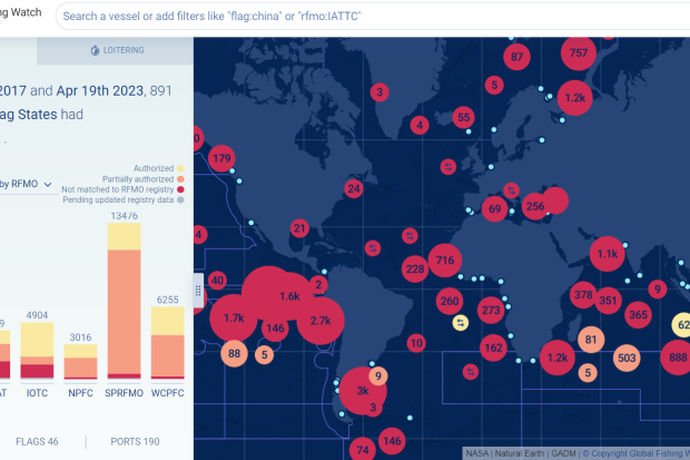
The Global Fishing Watch Carrier Vessel Portal can help compliance, MCS and enforcement officers analyze the activities of carrier vessels that transship catch from commercial fishing vessels and land this catch into ports around the globe for processing and further trade. The portal can be used to verify transshipment activities and identify when such activities are not being adequately reported.
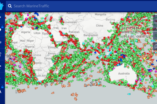
Marine Traffic gathers data from more than 18,000 AIS equipped volunteer contributors in over 140 countries around the world. Information provided by the volunteer AIS equipment includes vessel unique identification, position, course, and speed. This information is displayed on the website in real time. Marine Traffic also displays vessel photos that are submitted by registered users and are included in the Marine Traffic Photo Directory.
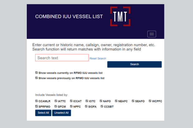
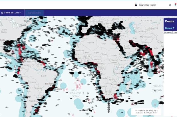
This site provides the best available, up to date information on all fishing vessels that appear on the IUU vessels lists published by Regional Fisheries Management Organisations (RFMOs) and related organisations. The Combined IUU Fishing Vessel List merges all available RFMO IUU vessel list sources into one list, that provides a single reference point to identify whether a vessel has been IUU listed. Vessels that have been IUU-listed in the past and subsequently delisted (for example as a result of a change in ownership, or because the vessel is no longer in service) are retained on the site, so that it contains a full historic record of IUU-listed fishing vessels.
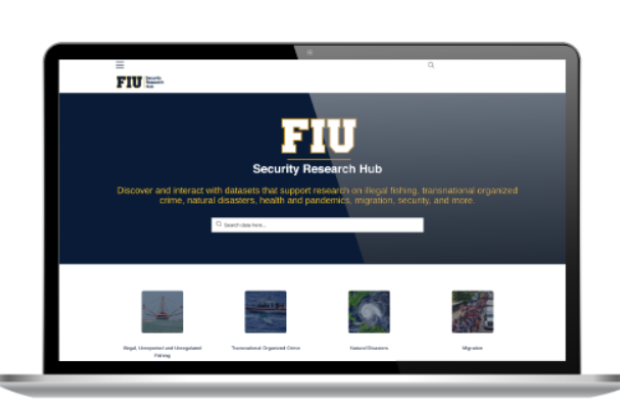
The Florida International University Security Research Hub - Data Hub allows you to discover and interact with maritime datasets that can support fisheries management and IUU fishing research. This includes more that 120 marine data sets including fishing effort, catch data and environmental and monitoring buoy data.
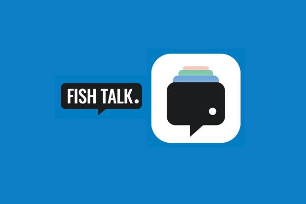
Fish Talk is a free app that has been developed by the Australian Fisheries Management Authority to break down the language barrier during at-sea and in-port inspections of foreign fishing vessels. The Fish Talk app supports the exchange of information by providing translations of key English phrases commonly used by fisheries officers into written and spoken Indonesian, Japanese, Korean, Chinese, and Spanish. The app also includes technical diagrams and reference images as well as other features to support the user.
Fish Talk is available to download for free from Google Play and the App Store.