Library

Tracking Refrigerated Transshipment Vessels to Inform the FAO's PSMA

Port State Measurement Agreements (PMSA) aim to combat IUU fishing by bringing international parties to enact legislation and regulation on foreign vessels entering port. Parties to the PMSA, Port-States, are responsible for monitoring whether a vessel has engaged in IUU fishing. Reefers (because of their role in transshipment) pose a serious problem in effectively tracking and monitoring IUU fishing, leading to harmful marine biodiversity activity and human rights abuses such as seafood slavery. However, reefers are readily equipped with Automatic Identification System (AIS) Technology which, this paper shows, has proven to be an effective tool in MCS that PMSA parties can continue to use.

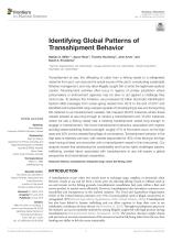
Identifying Global Patterns of Transshipment Behavior

Transshipment at high seas is very difficult to monitor, allowing the possibility of illegally caught fish to enter the legitimate seafood market, or enabling human rights abuses. This paper uses AIS data to track global transshipment behavior. They find that a majority of transshipment occurs at high seas outside of EEZ boundariesā€“areas that may lack national jurisdiction or where regulations are difficult to enforce. Additionally, possible transshipment encounters are happening with vessels flying flags of convenience. Together, these findings paint a scene of large transparency issues in global transshipment behaviors that will need to be addressed by governing bodies.

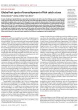
Global Hot Spots of Transshipment of Fish Catch at Sea

This study uses AIS data to identify when and where transshipment occurs, which fisheries and fleets are most involved in the practice, and what proportion of the high-seas catch is transshipped versus landed directly, altogether giving a detailed account of global seafood supply chains. Among many other findings, the study finds that fishing in EEZs was mainly landed directly, but on high seas, transshipment largely predominated. Fleet usage also differed with trawlers mainly used in EEZs and longline fishing dominated at high seas. The study ultimately shows how the type of catch and its location shape the infrastructure of the supply food chain involved (i.e. a history of poor monitoring, low compliance, and weak enforcement correlates with a large number of transshipments in Russian waters.) The findings of this study can aid in identifying where illicit activity can be happening and what warrants more monitoring, control, and surveillance.

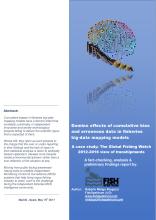
Domino Effects of Cumulative Bias and Erroneous Data in Fisheries Big-Data Mapping Models - Case Study of GFW View on Transshipments - FishSpektrum

Without a Worldwide Unique Vessel Identifier (WUVI) database, the International community has largely relied on data in self-created combined vessel lists for spatiotemporal mappings of fishing presence, effort, and footprint. Projects match fishing vessel registration identifiers to their alleged AIS MMSI numbers using these vessel lists. This study aims to prove that this method has yielded a large number of erroneous ship identification references. Global Fishing Watch, one of the largest vessel identification projects, is crosschecked with the vessel data that the study gathered and found that it suffers from major flaws and biases. Such errors put at risk both the creditability of the GFW and private/independent fisheries monitoring control & surveillance (MCS) initiatives. Not only should projects use more scientific responsibility, but a worldwide database could also help end the data-gathering methods that brought these mistakes about.